The nautical chart is the fundamental tool of every navigator. Whether printed on paper or displayed on a screen, it contains a wealth of essential information: depths, hazards, buoys, currents, harbours, and much more. Yet many recreational sailors exploit only a fraction of this wealth. This comprehensive guide will help you read, understand and use nautical charts like a true mariner.
What Exactly Is a Nautical Chart?
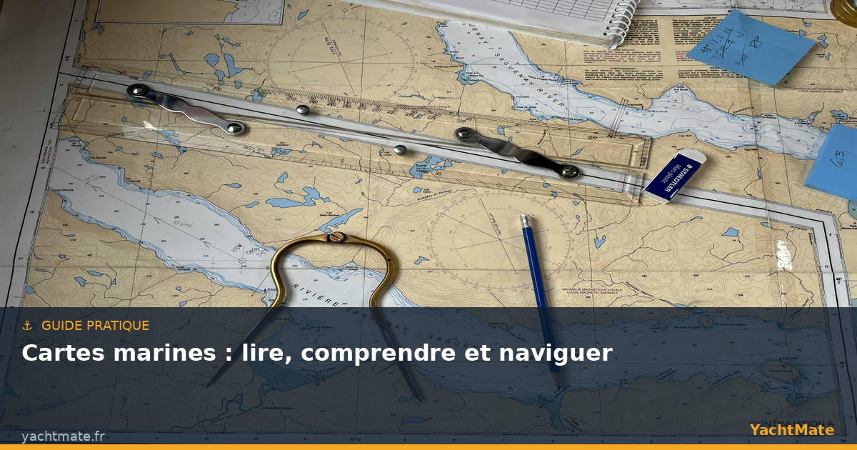
A nautical chart is a specialised cartographic representation of the sea and coastal areas. Unlike a road map, it focuses on what happens both below and above the water surface: seabed topography, shoals, wrecks, rocks, currents and navigational aids. In France, the SHOM (French Naval Hydrographic and Oceanographic Service) produces and updates official charts. In the UK, the UKHO publishes Admiralty charts. These paper charts serve as the official legal reference for navigation.
Nautical charts come in two main families: traditional paper charts and electronic charts (ECS or ECDIS depending on the system). Each format has its advantages, and every prudent navigator uses both in combination.
Download official charts in the YachtMate app to always have up-to-date charts available, even offline. Hydrographic updates are integrated regularly to reflect changes in buoyage and depths.
Understanding Chart Scale
Scale is one of the first things to check on a chart. It determines the level of detail available and therefore how you can use it:
- Large scale (1:10,000 to 1:50,000): ideal for harbours, channels and coastal approaches. Highly detailed, it shows every buoy, every rock and every critical depth.
- Medium scale (1:50,000 to 1:200,000): perfect for daytime coastal navigation, giving a good overview of the route between two ports.
- Small scale (1:200,000 to 1:5,000,000): reserved for offshore passage making and planning long voyages. Coastal details are minimised.
A golden rule: the closer you are to a coast or harbour, the larger the scale chart you should use. Navigating a channel with a 1:500,000 chart is dangerous — hazards are not represented with sufficient accuracy.
Depth Contours and Reading the Seabed
Depth contours (isobaths) — lines connecting points of equal depth — are the alphabet of the nautical chart. They draw the underwater relief and allow instant visualisation of the seabed topography. The figures on the chart express depth in metres below chart datum, corresponding to Lowest Astronomical Tide (LAT). In practice, the actual depth will therefore always equal or exceed the charted value.
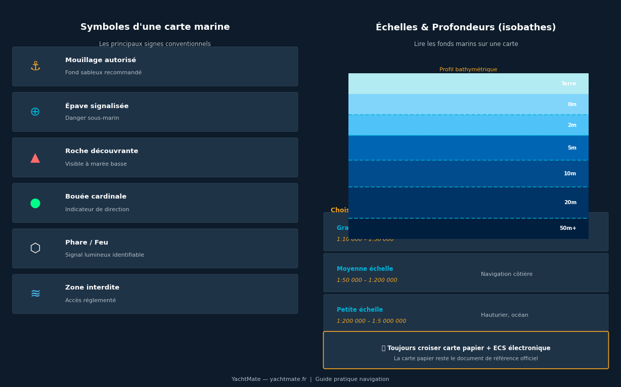
Colours also play an important role: light blue generally indicates shallow areas (less than 5–10 metres depending on the publisher), medium blue indicates intermediate depths, and white indicates deep water. Areas that dry at low tide (foreshores) are often shown in green or with specific hatching.
Spot Soundings
In addition to contours, the chart is scattered with spot soundings: individual numbers indicating a specific depth at a precise point. An underlined figure means the seabed dries at low tide — a potential hazard never to be ignored. Permanently submerged rocks are indicated by a dot or asterisk with a very shallow depth figure.
Essential Symbols to Know
The international standard INT 1 lists over 500 symbols. No need to panic — mastering the most common ones is sufficient for safe coastal sailing.
Hazards
- Drying rock: upward-pointing triangle + underlined figure (height above chart datum)
- Submerged rock: cross with central dot + depth figure
- Dangerous wreck: ship symbol with depth indication
- Shoal: contoured area with minimum depth figure
Navigational Aids
- Lights and lighthouses: magenta star on paper charts, with their characteristics (colour, period, range)
- Buoys: coloured symbols following the IALA buoyage system (Region A in Europe)
- Cardinal buoy: double triangle indicating the safe side to pass
- Lateral buoy: red to starboard (entering port), green to port
The INT 1 booklet is available as a free PDF from most national hydrographic offices. Keep a copy aboard to decipher rare symbols. In the YachtMate app, simply tap any symbol on the chart to display its full meaning.
Paper Charts vs Electronic Charts: Which to Choose?
The question is not which to choose, but how to use both. Regulations in most countries require carrying appropriate nautical charts for the intended voyage. Electronic charts offer considerable advantages in terms of ergonomics and safety — but they should never be your only reference.
Paper Charts
Official paper charts are the legal reference documents. They are updated via Notices to Mariners (NtM) published weekly by national hydrographic offices. Check these notices regularly and apply corrections to your paper charts — this is a legal requirement for professional vessels and a sound practice for all sailors.
Electronic Charts (ECS)
Electronic chart systems have revolutionised recreational navigation. They display your position in real time on the chart, automatically calculate routes, distances and bearings, and can generate alarms when approaching a hazard. The most common formats are CM93, S57/S63 (official vector format) and rasterised scanned charts. Vector charts allow zooming without loss of detail and display customisation — a considerable advantage underway.
"The electronic chart is a remarkable tool, but it does not replace the navigator's judgement. A power failure, a GPS fault or an out-of-date chart can put you in danger if you cannot navigate without them."
How to Plan Your Route on a Nautical Chart
Route planning is the navigator's fundamental exercise. It involves tracing a safe path between departure and destination, avoiding all hazards. Key steps include selecting appropriate scale charts for each section, identifying all dangers along the route, placing waypoints that give adequate clearance from