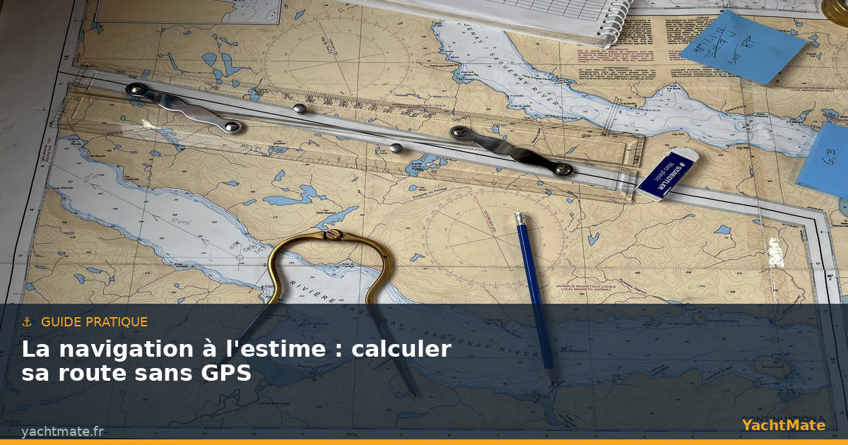
Long before GPS, generations of sailors crossed oceans armed with nothing more than a compass, a watch, a log and a chart. Their method had a name: dead reckoning. It consists of continuously calculating your position from the course steered, the speed and the time elapsed, then correcting that result for the leeway caused by wind and current. In an age when every phone displays a position accurate to the metre, dead reckoning can seem obsolete. Yet it remains a fundamental skill: the day the electronics fail, the battery dies or the signal vanishes, it is dead reckoning that brings you safely home. This guide explains, step by step, how to keep a running fix and calculate your route with confidence.
What is dead reckoning?
Dead reckoning is the technique that lets you deduce your present position from a known one, by adding the distance run since. The principle is purely geometric: if I know where I started, in which direction I am heading (the course), at what speed and for how long, I can plot on the chart the point where I should be.
The term "reckoning" says it plainly: this is not an exact position but an estimated position, carrying uncertainty. The longer you go without an external reference (a landmark, a sounding, a bearing), the more that uncertainty grows. This is why the good navigator regularly resets the dead reckoning whenever reliable information is available. Dead reckoning is not a substitute for GPS: it is the reasoning framework that lets you understand, verify and, if necessary, replace any electronic aid.
The four ingredients of dead reckoning
Keeping an accurate reckoning rests on four pieces of data you must record and log continuously.
The course steered
This is the direction the bow is pointing, read on the steering compass. Beware: the compass course is not the true course. It must be corrected for magnetic variation (the difference between true north and magnetic north, given on the chart) and for the boat's own deviation (the influence of metal masses on the compass). These corrections turn the compass course into the true course, the only one you plot on the chart.
Speed through the water
This is the boat's speed relative to the water, measured by the log, expressed in knots. One knot equals one nautical mile per hour. Mind the crucial distinction: speed through the water is not speed over the ground. In a current, a boat may show 6 knots through the water but make 8 knots over the ground if carried along, or only 4 knots if it is stemming the current.
Time elapsed
The clock is the most underrated instrument in dead reckoning. Noting the exact time at each change of course or speed lets you calculate the distance run on each leg. An error of a few minutes seems trivial, but accumulated over a long passage it shifts the position appreciably.
Leeway: wind and current
A boat never moves exactly along the axis of its course. The wind pushes it sideways (the leeway angle), especially when close-hauled on a sailboat. The current moves the entire mass of water — and the boat with it — regardless of the course. These two effects combined mean that the track actually made over the ground differs from the course shown on the compass.
Keep a simple but rigorous logbook: time, compass course, log speed, and any notable event (change of point of sail, landmark sighted, sounding taken). With YachtMate, your real track is recorded automatically: an excellent way to compare your calculated reckoning with the route actually made and to sharpen your sense of leeway.
The basic calculation: speed, time, distance
All of dead reckoning rests on a simple relationship every boater should know by heart:
Distance = Speed × Time
Distance is in nautical miles, speed in knots and time in hours. A few concrete examples: at 6 knots for half an hour you cover 6 × 0.5 = 3 miles. At 5 knots for 1 h 30 (that is 1.5 h) you make 5 × 1.5 = 7.5 miles. Conversely, to find how long a 12-mile leg takes at 4 knots, you invert the formula: Time = Distance ÷ Speed = 12 ÷ 4 = 3 hours.
This mental arithmetic, practised regularly, becomes second nature. It lets you estimate an arrival time, anticipate a tidal turn or judge whether you will round a headland before nightfall — decisions that depend on no electronics at all.
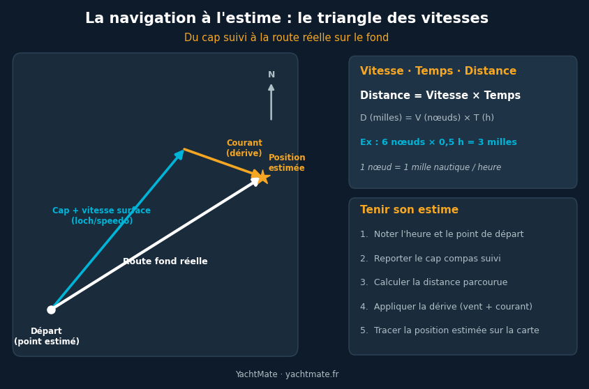
The vector triangle: from course to ground track
To go from the course steered to the track actually made over the ground, navigators use an elegant graphical tool: the vector triangle (or current triangle). The idea is to represent each motion as a vector — an arrow whose direction gives the heading and whose length gives the speed — then add them together.
- The boat vector: it starts at the point of departure, oriented along the true course, and its length represents speed through the water (for example 6 knots).
- The current vector: it is added at the tip of the previous one, oriented in the direction the current sets, its length being the current's speed (for example 2 knots).
- The ground-track vector: this is the arrow connecting the point of departure directly to the tip of the current vector. Its direction gives the actual ground track, its length the speed over the ground.
This plot reveals visually how much a beam current can push the boat off its intended route. It works both ways: either to predict where you will end up while steering a given course, or to determine the course to steer in order to offset the current and reach a precise destination — an essential calculation for crossing a tidal stream or aiming for a narrow channel.
To estimate the current, consult the tide tables and tidal stream atlases for your area: they give direction and rate hour by hour. YachtMate integrates tidal data to help you anticipate the strength and set of the current at the exact moment of your passage, and correct your course accordingly.
Keeping a reckoning in practice, step by step
Beyond the theory, dead reckoning is above all a discipline of regular upkeep. Here is the routine an organised crew follows:
- Note the point of departure and the exact time when slipping the lines or leaving an identified landmark.
- Plot the true course steered, corrected for variation and deviation.
- Calculate the distance run on each leg from speed and time elapsed.
- Apply the leeway from wind and current using the vector triangle.
- Plot the estimated position on the chart, marking it with a ringed dot and the time.
Repeated every hour (or more often in tricky areas), this routine maintains a reliable picture of your position even without any visual reference. Each time a landmark, a lighthouse or a distinctive sounding appears, compare it to your reckoning: if the gap is small, your upkeep is good; if it is large, reset without hesitation and look for the cause (underestimated current, stronger leeway than expected, course error).
Resetting the reckoning and managing uncertainty
A reckoning is never perfect, and that is normal. Errors accumulate: compass imprecision, rough log readings, poorly assessed current, helm held irregularly. The experienced navigator does not seek absolute precision but thinks in terms of an area of uncertainty: they know their real position lies somewhere within a circle around the estimated point, a circle that grows with the time elapsed since the last reset.
To tighten that uncertainty, you use any reference available: a bearing on a lighthouse or landmark, a distinctive sounding compared to the chart, a transit of two marks (a leading line), or the passing of a buoy. Each of these resets the reckoning and makes it reliable again. It is this constant exercise — estimate, verify, reset — that makes the good skipper.
Why learn dead reckoning in the GPS age?
You might think dead reckoning obsolete. Quite the opposite. First, because electronics fail: a flat battery, a drowned antenna, a jammed signal, and your position vanishes from the screen. Without dead reckoning you are then blind. Second, because dead reckoning develops seamanship: understanding how wind and current distort your route makes you a better helmsman and a better strategist, even with the GPS on. Finally, because it lets you check the electronics: an aberrant GPS position (it happens) is spotted at once if it contradicts your reckoning. The GPS gives the position; dead reckoning gives the understanding.
Sail with greater peace of mind with YachtMate
Nautical charts, tides, track recording and route planning in a single app designed for recreational boaters. Available on iOS and Android.
Discover YachtMate →