In the age of ubiquitous GPS, one might think the compass has become a relic of the past. Yet every serious sailor knows that an electronic instrument can fail, lose power, or simply be disrupted by interference. Mastering compass navigation remains a fundamental skill — and a requirement for any offshore sailing qualification. In this article, we demystify the three concepts that trip up many recreational sailors: compass heading (CH), deviation (d) and magnetic declination (D).
The Magnetic Compass: Principles and Types
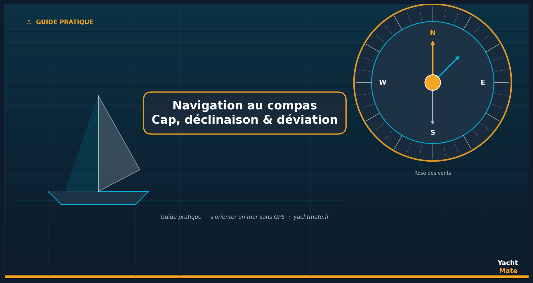
A magnetic compass works through the natural alignment of a magnetised needle with the Earth's magnetic field. It's simple, reliable, and requires no external power source. On board a sailboat or motorboat, you'll mainly encounter two types:
- The card compass: mounted on the dashboard or binnacle, it features a compass rose suspended in liquid (damping). This is the most common type on cruising sailboats.
- The fluxgate compass: an electronic sensor coupled to the autopilot or navigation centre. It provides a very precise digital heading, but requires electrical power.
In all cases, the compass points to Magnetic North — not the geographic North (the North Pole) shown on your charts. This difference is the source of all the complexity in compass navigation.
The YachtMate app displays your magnetic heading and true heading in real time, with automatic correction for local declination. Perfect for checking your compass calculations at a glance, even without an internet connection thanks to integrated offline charts.
The Three Headings You Need to Know
To get from point A to point B, you need to maintain a precise heading. But which heading are we talking about? In navigation, there are three conventions, and confusing them can put you several miles off your destination.
Compass Heading (CH)
This is the raw value read from your onboard navigation instrument. It is affected by local magnetic disturbances generated by the metal hull, electrical equipment, speakers and other devices. This error is called deviation.
Magnetic Heading (MH)
Once corrected for deviation, you get the magnetic heading, oriented towards Magnetic North. This heading is used for compass bearings and for reading marine charts that indicate magnetic headings (currents, routes, instructions).
True Heading (TH)
This is the heading oriented relative to geographic North, the north of meridians on your paper or digital chart. To convert from magnetic heading to true heading, you apply magnetic declination. This is the heading you plot on your Navionics or paper chart.
Deviation: Your Boat's Own Error
Deviation (noted d) is the angle between Magnetic North and what your compass actually points to. It is caused by the metal masses on board (engine, fuel tank, fittings) and by the electromagnetic fields of devices (VHF radio, autopilot, wiring…). Its key characteristic: it changes depending on the heading the boat is sailing.
Creating a Deviation Table
To know your compass deviation, you need to create a deviation curve — also called "compass compensation". In practice, you compare the heading shown by your compass with a reference heading (taken from a known coastal transit, or with a GPS). You go through all headings (0°, 30°, 60°… up to 360°) and note the difference for each. This gives you a deviation table specific to your boat.
- If your compass reads 090° and the actual heading is 093°, the deviation is +3°E (east).
- If your compass reads 270° and the actual heading is 268°, the deviation is −2°W (west).
Deviation under 5° is generally acceptable. Beyond that, it is recommended to have the compass compensated by a specialist, who will place small compensating magnets inside the compass housing to cancel the influence of metal masses.
You can use YachtMate to quickly build your deviation table: activate precise GPS tracking and compare headings shown by your ship's compass with those in the app for each sector. The route recording feature lets you replay the session back at the dock.
Magnetic Declination: The Earth's Own Error
Magnetic declination (noted D) is the angle between geographic North (the North Pole) and Magnetic North (where an undisturbed compass points). It varies by location on the globe and changes slightly each year. For the French Mediterranean in 2026, declination is approximately 1° to 3° East depending on the area. In the North Atlantic, it can reach 5° to 8° West.
Declination is indicated on every marine chart, often in a cartouche or annotation on the compass rose. Modern digital charts (including those used by YachtMate) automatically calculate and apply local declination, but understanding the principle is essential for truly independent navigation.
East vs West Declination: How to Stay on Track
The mnemonic is straightforward: East = add, West = subtract (when converting magnetic heading to true heading). In other words:
- East declination (D > 0): Magnetic North is east of True North → TH = MH + D
- West declination (D < 0): Magnetic North is west of True North → TH = MH − |D|
"A navigator who confuses magnetic heading and true heading in the Atlantic can find themselves 8 miles off their planned route after only 60 miles sailed."
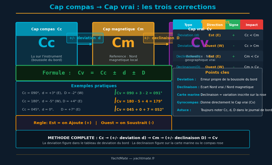
The Complete Formula: From CH to TH
Combining deviation and declination, the complete conversion is written:
TH = CH ± d ± D
Where:
- CH = compass heading (read from the instrument)
- d = deviation (specific to the boat and heading, from the table)
- D = magnetic declination (shown on the chart, specific to the area)
- TH = true heading (plotted on the chart)
Practical example: You want to reach a port whose true bearing is 045°. Local declination is +2°E. Your deviation table shows d = −3° for this heading. What heading should you steer on your compass?
- TH = 045°
- MH = TH − D = 045° − 2° = 043°
- CH = MH − d = 043° − (−3°) = 046°
You should steer 046° on your compass to follow a true heading of 045°.
Practical Tips for Compass Navigation
Protect Your Compass from Interference
Avoid placing metal objects, phones, handheld VHF radios or Bluetooth speakers near your compass. A simple radio placed 20 cm away can create a deviation of several degrees. On modern boats, USB chargers and frequency converters are also common sources of interference.
Check Your Deviation Regularly
Deviation can change if you modify the boat's equipment (new VHF radio, moving the fuel tank, replacing the anchor…). It is advisable to redo a deviation curve after any significant modification and at least once per season.
Keep Your Logbook Up to Date
Systematically record in your logbook the compass heading steered and the corrections applied. In case of GPS failure, you will be able to reconstruct your route by dead reckoning, combining heading, speed and time.
Conclusion
Mastering compass navigation means understanding that your compass needle doesn't point exactly to the north on your chart — and knowing how to correct this difference methodically. Declination and deviation are two distinct sources of error: one related to the Earth, the other to your boat. By understanding them and applying the formula TH = CH ± d ± D, you will navigate with greater precision and confidence, even far from any GPS signal.
The compass remains the ultimate guardian of your orientation at sea. Take the time to truly know it, and it will never let you down.
🧭 Navigate with YachtMate
YachtMate displays magnetic heading, true heading and local declination in real time, with offline marine charts for fully autonomous navigation — even without signal.
Discover YachtMate →